Topography plays a vital role in shaping the climate of a region. While factors like latitude, altitude, and ocean currents often take the spotlight in discussions about climate, the influence of landforms such as mountains, valleys, and plateaus is equally significant. The physical features of Earth not only alter the movement of air and water but also create unique microclimates that can vary dramatically within short distances. In this topic, we explore how topography affects climate, diving into its impact on temperature, precipitation, wind patterns, and localized weather systems.
Elevation and Temperature
One of the most direct ways topography affects climate is through elevation. As elevation increases, the atmosphere becomes thinner and is less able to hold heat. This results in a decrease in temperature. For every 1,000 meters (or roughly 3,280 feet) gained in elevation, the temperature typically drops by about 6.5°C (or 11.7°F). This phenomenon explains why mountainous regions often have cooler climates than nearby lowland areas, even if they are located at the same latitude.
This temperature drop can lead to stark differences in climate over short distances. For example, tropical regions with high mountains, such as the Andes or the Himalayas, have snow-capped peaks despite being near the equator. These cooler temperatures also influence vegetation, animal life, and human activities in elevated regions.
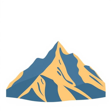
Mountains and Precipitation Patterns
The Rain Shadow Effect
Mountains act as barriers to the movement of moist air, leading to significant variations in rainfall. When moist air from oceans or lakes moves inland and encounters a mountain range, it is forced to rise. As the air ascends, it cools and condenses, forming clouds and precipitation on the windward side of the mountain. This process is known as orographic lift.
After the air mass passes over the peak, it descends on the leeward side of the mountain. As it descends, it warms and becomes drier, often creating arid or semi-arid conditions. This phenomenon is known as the rain shadow effect. Regions such as the eastern side of the Sierra Nevada in the United States or the Atacama Desert behind the Andes are prime examples of how topography influences precipitation patterns.
Increased Rainfall in Uplands
Even outside of rain shadow regions, upland areas tend to receive more rainfall than lowlands. This is because rising terrain promotes cloud formation and precipitation, especially when combined with prevailing winds carrying moisture. This explains why some mountainous areas, like the Western Ghats in India or the Scottish Highlands, receive heavy rainfall year-round.
Topography and Wind Patterns
Topography can channel, block, or redirect wind patterns, influencing the climate of both local and surrounding areas. Valleys, for example, can act as natural wind tunnels, focusing and accelerating airflow. Mountain gaps and passes also play a crucial role in guiding wind movement, sometimes leading to intense localized winds such as the Mistral in southern France or the Santa Ana winds in California.
On a broader scale, mountain ranges can obstruct global wind currents. For example, the Himalayas act as a climatic barrier, influencing the monsoon patterns of South Asia. In winter, they block cold air masses from Central Asia, helping to keep parts of the Indian subcontinent warmer than they otherwise would be.
Microclimates Created by Topography
Topographic features often give rise to microclimates small areas with climatic conditions that differ from the surrounding region. These microclimates can be found in valleys, hillsides, and even urban areas surrounded by natural landforms. Here are some examples of how topography contributes to microclimates
- ValleysCold air tends to sink into valleys at night, causing temperatures to drop more rapidly than on the surrounding slopes. This leads to cooler, more stable air and frequent frost formation, even in relatively warm regions.
- South-facing slopesIn the Northern Hemisphere, south-facing slopes receive more sunlight and are typically warmer and drier than north-facing slopes. This affects agriculture, vegetation growth, and the timing of snowmelt.
- Urban basinsCities located in topographic basins can trap air pollutants and experience extreme temperature fluctuations due to limited air circulation.
Topography and Climate Zones
Large-scale topographic features can influence the classification of climate zones. For example, the presence of mountain ranges often marks the boundary between different climate zones. The Andes Mountains in South America separate the humid Amazon Basin from the dry coastal deserts of Peru and northern Chile. Similarly, the Rocky Mountains in North America divide the continent into distinct eastern and western climate patterns.
Plateaus, another major landform, often have unique climates due to their combination of elevation and flat terrain. The Tibetan Plateau, for instance, is one of the highest and largest plateaus in the world. Its climate is cold and dry, heavily influenced by both its altitude and surrounding mountains, which block moisture from reaching the interior.
Topography’s Role in Seasonal Weather Patterns
Topography doesn’t just affect long-term climate but also plays a significant role in seasonal weather variations. For instance, snow accumulation in mountainous areas can impact water availability in surrounding lowlands during warmer months. The melting of snow provides freshwater for agriculture, hydropower, and human consumption in many regions across the world.
Additionally, mountains can delay the arrival of seasonal winds. During the summer monsoon in South Asia, the Western Ghats and Himalayas influence when and where the rains begin. In winter, topography can trap cold air masses, prolonging frost or freezing conditions in valleys and basins.
Case Studies Real-World Examples
The Himalayas and the Indian Subcontinent
The Himalayas provide a classic example of how topography shapes climate. This massive range blocks frigid winds from Central Asia, helping maintain milder winters in northern India. During summer, the Himalayas also trap moisture-laden winds from the Indian Ocean, intensifying monsoon rainfall on the southern slopes while leaving areas to the north relatively dry.
The Andes and South America
In South America, the Andes Mountains create sharp contrasts in climate. The western slopes receive abundant rainfall from the Pacific, while the eastern side feeds into the lush Amazon rainforest. Yet just behind the range lies the Atacama Desert one of the driest places on Earth due to the strong rain shadow effect.
The Alps and European Climate
The Alps influence weather patterns across much of Europe. They block cold northern air masses from reaching the Mediterranean, keeping southern Europe relatively warm. They also generate local wind systems, like the Föhn wind, which can rapidly raise temperatures on the leeward side and cause sudden snowmelt or avalanches.
Why Topography Matters in Climate Understanding
Understanding how topography affects climate is essential for making accurate weather predictions, managing agriculture, planning cities, and preparing for natural disasters. Elevation, slope orientation, and mountain barriers all interact with atmospheric forces to create a diverse mosaic of climatic conditions across the globe. From shaping rainfall to controlling temperature and influencing wind, the land beneath our feet plays a silent but powerful role in the world’s climate system.
As we continue to study climate change and its regional impacts, topography will remain a critical factor in understanding why some areas are more vulnerable than others. By recognizing the influence of Earth’s surface features, we gain a deeper appreciation for the complexity and variability of our planet’s climate.